Home > About the Treaty > Maps and Territory
Maps and Territory
Che:k’tles7et’h’
Where land, water, and governance meet
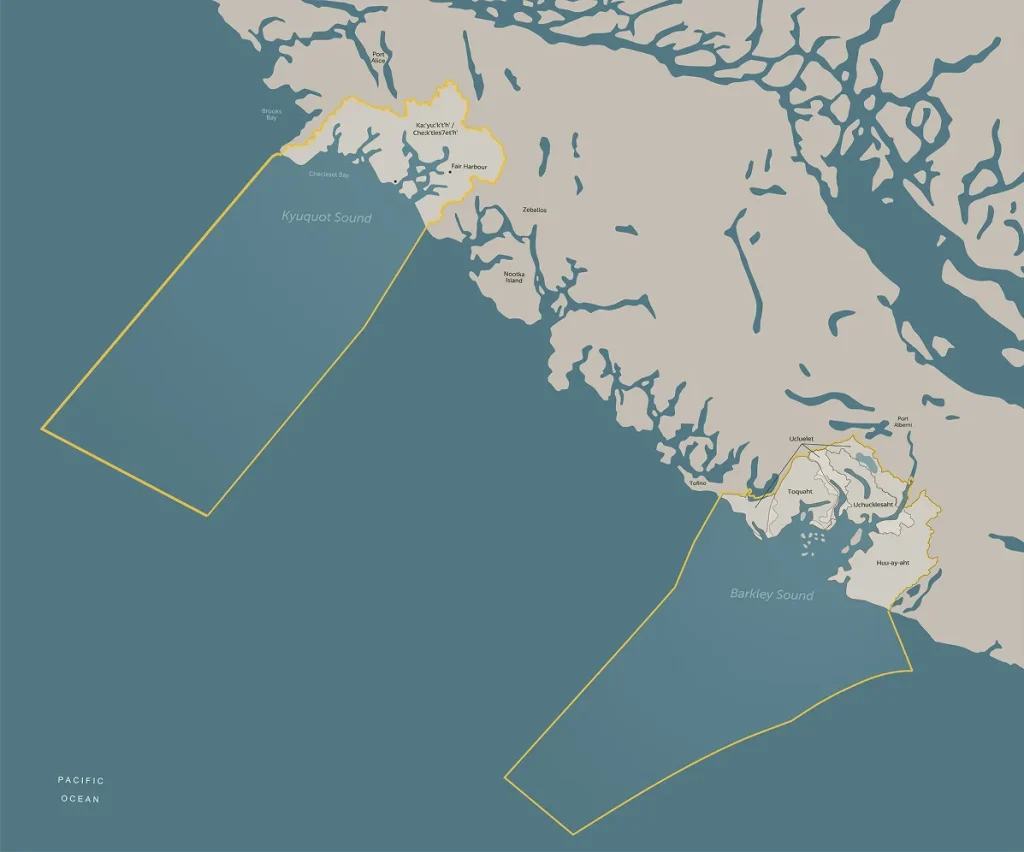
The five Maa-nulth Nations’ areas stretch from Barkley Sound to Kyuquot Sound, representing both ancestral stewardship and contemporary sovereignty—where traditional knowledge guides modern governance.
From mountains to marine corridors, the Maa‑nulth territories form the foundation of self-governance. These maps reflect legal recognition of lands and waters within the Maa‑nulth Treaty.
West Coast territories
The Maa‑nulth Nations have stewarded their territories along Vancouver Island’s west coast for thousands of years. Through the Treaty, these connections are formally recognized within Canada’s constitutional framework.

Traditional territory areas
Beyond treaty lands, the Nations maintain important roles within broader areas, providing opportunities for:
- Resource development consultation and revenue sharing
- Protected area management participation
- Environmental assessment engagement
- Resource harvesting
Maa‑nulth territories stretch along pristine coastline from Barkley Sound to Kyuquot Sound, encompassing ancient forests, productive marine environments, traditional village sites, and important fish and wildlife habitats.
Learn more


